The Nation's Largest Paved Trail Network
Ohio’s Miami Valley region provides over 375 miles of paved, multi-use trails. Stretching across county lines, these trails connect schools, parks, historic landmarks, and area attractions. Path users travel through meadows, scenic countryside, forested areas, and city centers. Our great system of trails enhances both the wellness and quality of life of Miami Valley residents and visitors. All trails are free and open to the public every day of the year, from dawn until dusk.
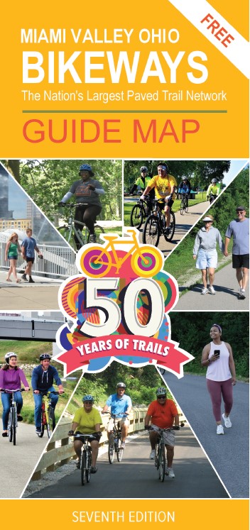
The cover of our Seventh Edition Bikeways Map celebrates fifty years of trails in the Miami Valley. Starting with the first mile of the trail, constructed in Troy in 1973, the Region has seen continuous growth and popularity of our trails network. Today the Miami Valley Trails connect over 40 communities in 11 counties.
We hope you find the Bikeways Map useful when planning your commute or your next outdoor adventure—whether running, biking, skating, or walking through the Miami Valley area.
How to get your bikeways map
The 7th Edition Miami Valley Ohio Bikeways Map for the Miami Valley is now available. This award-winning map is only published every 3 years. There are several ways to get a copy of the map.
- Pick up a free map at one of our physical locations
- Download the map as a PDF
- Order your map online
Who's got the bikeways map
You can pick up a free map at one of the following locations. Please call ahead to confirm hours during this time.
- Clark County Park District - 5638 Lower Valley Pike, Springfield, Ohio - 937-882-6000
- National Trails Parks and Recreation District - 1301 Mitchell Blvd., Springfield, Ohio - 937-328-7275
- Greene County Parks & Trails - 635 Dayton-Xenia Rd., Xenia, Ohio - 937-562-6440
- Miami County Park District - 2645 East State Route 41, Troy, Ohio - 937-335-6273
- Five Rivers MetroParks - 409 E. Monument Ave., 3rd Floor, Dayton, Ohio - 937-275-7275
- Centerville-Washington Park District - 221 N. Main St., Centerville, Ohio - 937-433-5155
Are you visiting the Miami Valley Region soon?
You can order a Miami Valley Bikeways Map online. MVRPC will ship a paper copy of the map directly to you. If you are interested in obtaining a map, please be advised of these guidelines:
- One map per person is available at no charge.
- Larger quantity requests are charged a very low printing cost and filled only if quantities are available.
- To request more than one map, call Matt Lindsay at 937-531-6548.
- To request a map be sent to you, please fill out the form (all fields required), then click 'Submit.'
Order online from MVRPC
To request a map be sent to you, please fill out the form (all fields required), then click 'Submit'.
Supporting partners
Thanks to these sponsors who provide critical funding to print these maps, enabling the park districts, bike shops, and local governments to provide the maps free-of-charge!
National Park Service
Gold Level Sponsors



Silver Level Sponsors

Bronze Level Sponsors